Lesson 1: Tools of Scientific Exploration
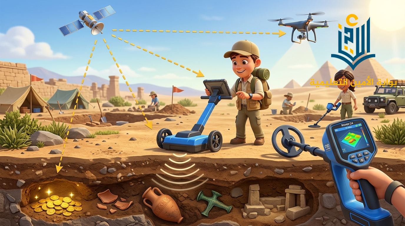
Welcome explorers! Did you know that scientists and archaeologists can discover ancient secrets, hidden ruins, and buried treasures without doing any digging? In this lesson, learn how space satellites, drones, GPS, Ground Penetrating Radar, and magnetometers make exploration faster, safer, and smarter!
When archaeologists (علماء الآثار) and scientists explore an area, they rely on advanced technology before ever picking up a shovel.
Save Time (توفير الوقت)
Locate sites quickly without searching blindly for months.
Save Effort (توفير المجهود)
Avoid exhausting manual excavations in wrong spots.
Save Cost (توفير التكلفة)
Scan and identify valuable targets before spending heavy budgets.
What Can Exploration Tools Detect?
Exploration tools help scientists detect objects buried beneath the ground, such as:
Scientists divide exploration tools into two main categories depending on where the tool is used:
Stage 1: Above the Ground
فوق سطح الأرضUsed from the sky and space to scan landscapes, photograph terrain, and determine coordinates.
- Orbit high in space above Earth.
- Take photographs of Earth from above to map wide geographical areas.
- Remotely controlled flying aircraft without human pilots.
- Capture close-up, high-resolution photographs of hard-to-reach archaeological sites.
- Stands for: Global Positioning System.
- Uses satellites to find the exact location of places and navigate routes.
- Used by tourists, drivers, delivery apps, and explorers.
Stage 2: Under the Ground
تحت سطح الأرضSensors and radars used to "see" inside the soil without excavating or breaking ground.
- A high-tech 3D ground scanner.
- Detects metals and buried objects beneath the soil.
- Creates 3D images that reveal the exact location and depth of targets.
- Known as: الرادار المخترق للأرض.
- Uses radar waves to detect non-metallic buried objects, ancient walls, and hidden chambers underground.
- Specialized device that measures the magnetic field.
- Detects metals underground (iron weapons, ancient coins, bronze artifacts).
Quick Summary Table (جدول المقارنة السريع):
| Tool Name | Position | How It Works | Target Detected |
|---|---|---|---|
| Satellites | Above Ground | Takes photos from space | Wide landscapes & geographic maps |
| Drones | Above Ground | Remote aerial photography | High-resolution site views |
| GPS | Above Ground | Connects to satellites | Exact geographic location & directions |
| GPR | Under Ground | Sends radar wave pulses | Buried structures, walls & relics |
| Magnetometer | Under Ground | Measures magnetic fields | Underground metals & coins |
| Rover C4 | Under Ground | 3D ground scanning sensor | 3D visual images + depth of targets |
Click on any tool below to test how an explorer uses it in the field:
Satellites (الأقمار الصناعية)
Stage: Above the GroundSatellites orbit Earth high above the atmosphere. They take comprehensive photographs from space, giving scientists a bird's-eye view of large historical regions.
| English Term | المعنى باللغة العربية |
|---|---|
| Exploration Tools | أدوات الاستكشاف |
| Above the Ground | فوق سطح الأرض |
| Under the Ground | تحت سطح الأرض |
| Satellites | الأقمار الصناعية |
| Drones | طائرات بدون طيار |
| Global Positioning System (GPS) | نظام تحديد المواقع العالمي |
| Ground Penetrating Radar (GPR) | الرادار المخترق للأرض |
| Magnetometer | مقياس المغناطيسية |
| Magnetic Field | المجال المغناطيسي |
| Rover C4 (3D Ground Scanner) | ماسح أرضي ثلاثي الأبعاد |
| Buried Objects | أجسام مدفونة |
| Antiquities & Treasures | آثار وكنوز |
| Depth & Location | العمق والموقع |
Answer the following 5 questions to test your mastery of Lesson 1!
التعليقات والمناقشة